
: failed to open stream: Invalid argument in <b>/home/servuzmq/minisites/siteT1/common/template/carteV2.php</b> on line <b>139</b><br />
)
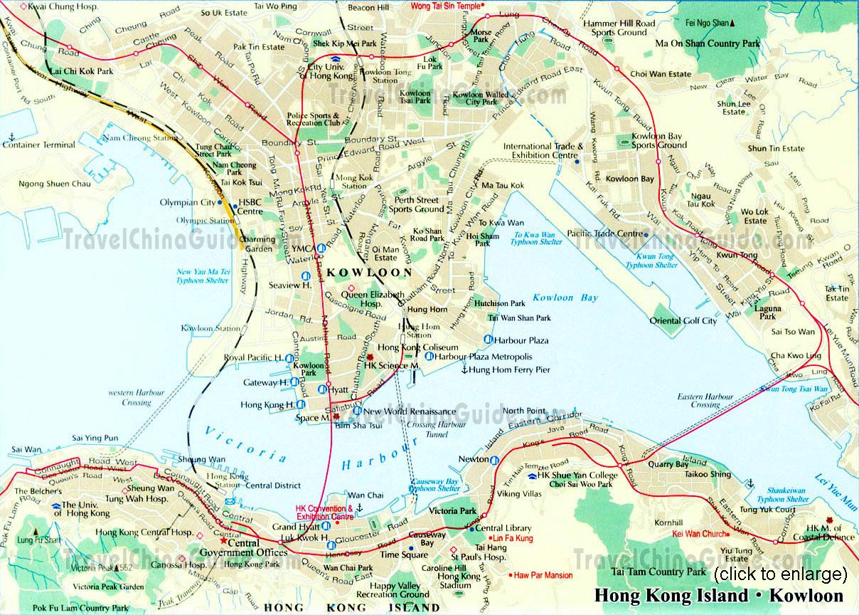
You can find on this page the Hong Kong streets map to print and to download in PDF. The Hong Kong roads map presents the road network, main roads, routes and motorways of Hong Kong in China.
The Hong Kong streets map shows all street network and main roads of Hong Kong. This streets map of Hong Kong will allow you to find your routes through the streets of Hong Kong in China. The Hong Kong streets map is downloadable in PDF, printable and free.
Every city has street names that reveal a thing or two about the place history and culture, and Hong Kong city is no exception. As is often the case with former British colonies, many Hong Kong streets are named after former governors or English dignitaries as its mentioned in Hong Kong streets map.
Des Voeux and Arbuthnot streets were named after the tenth governor of Hong Kong and a British civil servant respectively (see Hong Kong streets map). Others, like Flower Market street, are simply named after the shops found there. But there are some streets in Hong Kong with backstories you had never have guessed.
Properly known as Des Voeux street West and located in the Sheung Wan district of Hong Kong Island as you can see in Hong Kong streets map, Dried Seafood Street is home to a variety of vendors selling salted, pickled and dried ingredients for Chinese food dishes and traditional medicines in Hong Kong.
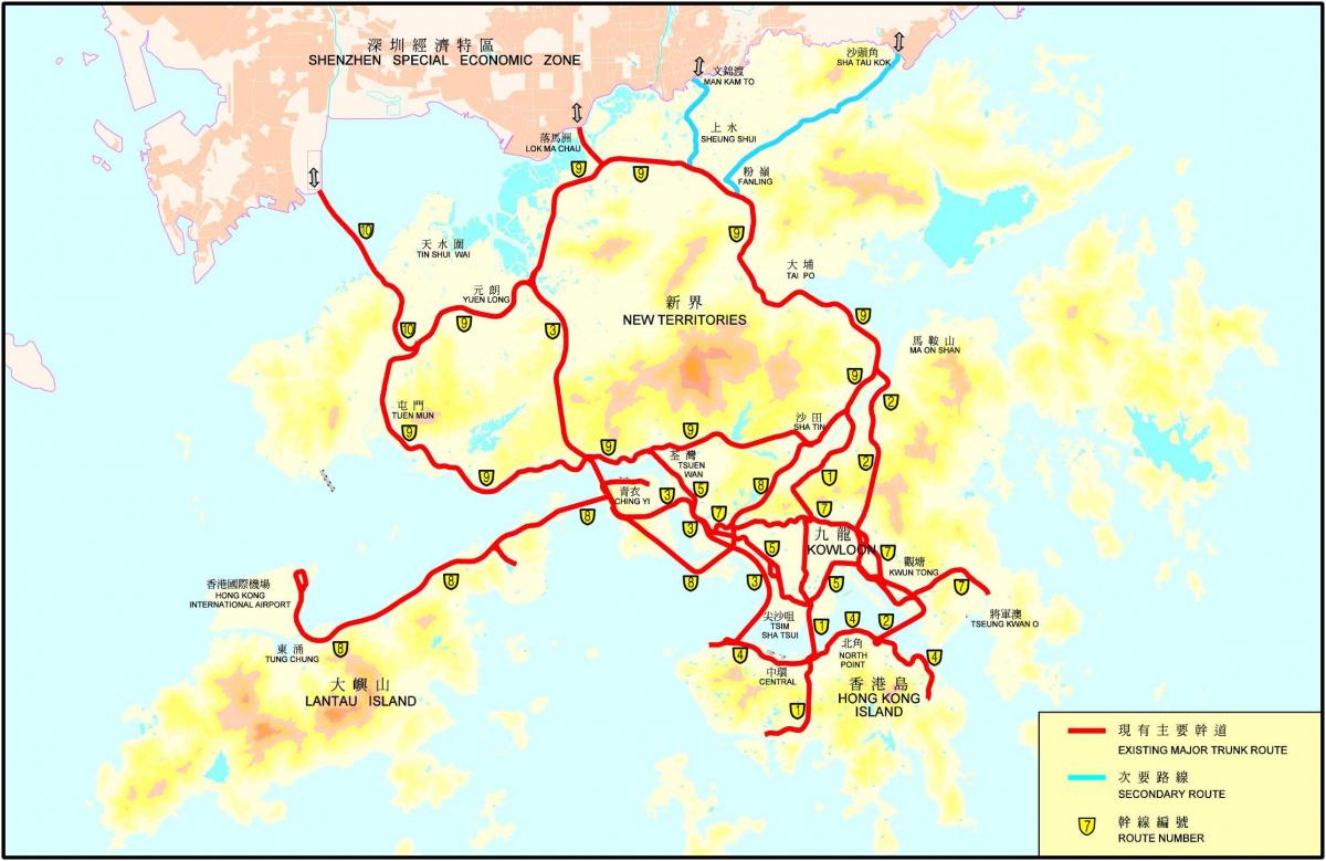
The Hong Kong roads map shows all road network and highways of Hong Kong. This roads map of Hong Kong will allow you to find your routes through the roads and motorways of Hong Kong in China. The Hong Kong roads map is downloadable in PDF, printable and free.
The Hong Kong Strategic Route and Exit Number System (Traditional Chinese: 香港主要幹線及出口編號系統) is a system adopted by the Transport Department of the Hong Kong Government to organise the major roads in the territory of Hong Kong into Routes 1 to 10 for the convenience of drivers (see Hong Kong roads map).
The Hong Kong road system comprises nine major series of roads in Hong Kong as its shown in Hong Kong roads map, numbered Routes 1 to 5 and 7 to 10, which can be classified into three categories: the three north-south routes of Hong Kong, the five east-west routes and the New Territories Circular Road.
The route numbers in Hong Kong are painted green, black or blue on yellow "road-shields" on overhead roadsigns. Hong Kong road system implemented exit numbering on the aforementioned routes (see Hong Kong roads map). Exit numbers are indicated by white in black rectangular boxes on overhead and roadside signs.
